Day 3 - May 31
Pioneer Productions
Having arrived back in Dodge
City at 3 AM, we got off to a sluggish start, but managed to stir because
of our anticipation with Pioneer Productions. We had absolutely no
idea of what lied ahead. The Pioneer team was composed of four members
that included producer Brian Leckey who visited Carroll High last month.
The team was delayed one day because their chase vehicle was literally
destroyed by baseball sized hail two days before. They were caught
when their vehicle developed a flat tire forcing them to "ride out the
storm."
 Our
chase vehicle began a slight transformation when Pioneer began to connect
the cameras and
Our
chase vehicle began a slight transformation when Pioneer began to connect
the cameras and 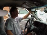 microphones.
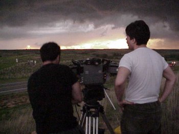
One camera was on a side window in the back of the vehicle. Producer
Brian Leckey rode in the passenger seat with a hand-held camera.
Cameraman David Maguire of Sydney, Australia rode in Pioneer's chase vehicle
and videoed from the window. Also in our vehicle was a sound producer
who monitored the sound level of the video.
microphones.
One camera was on a side window in the back of the vehicle. Producer
Brian Leckey rode in the passenger seat with a hand-held camera.
Cameraman David Maguire of Sydney, Australia rode in Pioneer's chase vehicle
and videoed from the window. Also in our vehicle was a sound producer
who monitored the sound level of the video.
Our target area for the day was
Woodward, Oklahoma. While enroute, the Pioneer team filmed first
from their vehicle taking several shots passing our vehicle, then dropping
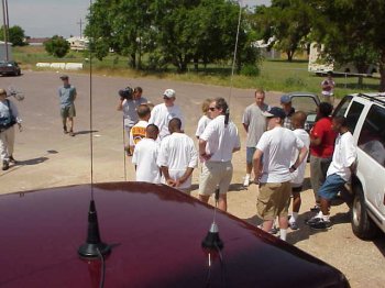
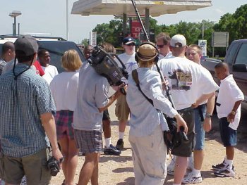
back. After reaching the target area, we stopped at a local convenience
store where we experienced "chaser convergence." Several chasers
joined together to discuss the latest strategies while gathering more up-to-date
information.
 We remained at the store for about
an hour and decided to move outside of town for a better view of the horizon.
Pioneer decided to film a small segment in which we (the two chase vehicles)
were to top a hill, pull to the side of the road, and jump out to discuss
the current situation. It took three attempts; but, we finally got
it.
We remained at the store for about
an hour and decided to move outside of town for a better view of the horizon.
Pioneer decided to film a small segment in which we (the two chase vehicles)
were to top a hill, pull to the side of the road, and jump out to discuss
the current situation. It took three attempts; but, we finally got
it.
After the staging, it was time
for real action. We chased several storms in and around the Woodward
area but none produced. Late in the afternoon, we received reports
of an isolated supercell in southern Kansas just west of Meade. The
storm had already produced a large tornado in an open field. With
an estimated time of arrival of only 45 minutes, we quickly set out to
intercept the storm.
Nearing the Kansas border near
Buffalo, Oklahoma, we were began to see significant cloud structure through
the hazy skies. Soon thereafter we witnessed at least a large wall
cloud with a lowering very near the ground. From our position, however,
we could not tell whether or not the lowering was on the ground.
We continued north where we ran into the VORTEX chase team as well as Doppler-On-Wheels
(DOW). 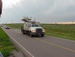 Some
careful maneuvering placed us on a large crest with an excellent view.
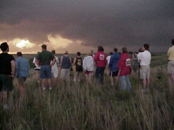
Upon our arrival, only five chase vehicles were on the scene. This
quickly changed. Within 20 minutes, over 60 vehicles were present
with over 100 chasers converging. It was the "Woodstock" of chaser
convergence.
Some
careful maneuvering placed us on a large crest with an excellent view.
Upon our arrival, only five chase vehicles were on the scene. This
quickly changed. Within 20 minutes, over 60 vehicles were present
with over 100 chasers converging. It was the "Woodstock" of chaser
convergence.
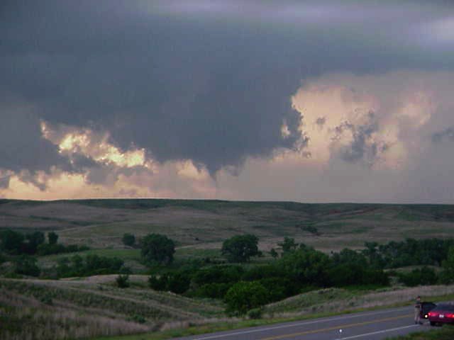
Atop the hill, we observed a
very agitated wall cloud which produced many short-lived funnels.
One funnel did manage to form a needle like multiple vortex tornado which
was on the ground for less than one minute. After some quality observing,
the storm performed a right move like its predecessors causing the crew
to make a quick and orderly exit.
 The storm continued to move to the
southeast producing several microbursts. After moving away at some
distance we stopped on the top of a hill to make new observations when
we were slammed by a microburst that registered a wind gust of 46 mph on
our mobile weather station. Again, we made a quick exit to the west
back toward Buffalo.
The storm continued to move to the
southeast producing several microbursts. After moving away at some
distance we stopped on the top of a hill to make new observations when
we were slammed by a microburst that registered a wind gust of 46 mph on
our mobile weather station. Again, we made a quick exit to the west
back toward Buffalo.
A second microburst struck the
ground approximately five miles to our west which created a large and spectacular
dust storm in our path. As we approached the storm, we stopped to
make sure that no rotation was present before proceeding. We entered
the dust storm and experienced strong cross winds and near zero visibility.
We headed back to Dodge City
for a much deserved rest and food.