December 18, 2002
The storm continued to move northeast along the line axis and continued to be "Tail End Charlie" throughout its life. Strong rotation with this storm began to develop as the storm moved into northern Lincoln Parish. The only confirmed tornado produced was in northern Union Parish near the community of Laran. The initial touchdown appeared to have been near Louisiana 550 approximately two miles south of Laran. The tornado moved to the northeast for two miles initially damaging trees and power lines near highway 550. Its path was about 100 yards wide. Near the end of its life cycle, it produced F1 damage to two homes and a barn.
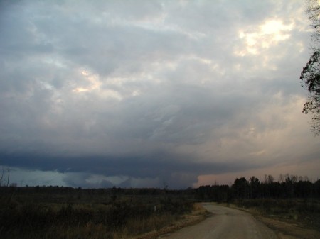
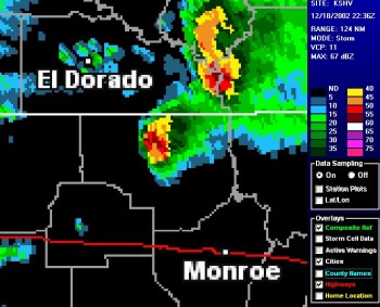
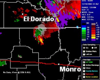
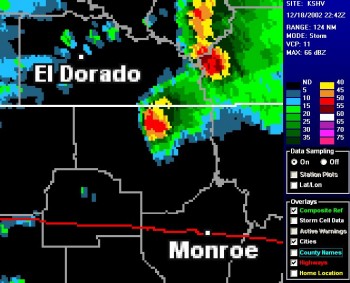
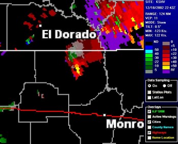
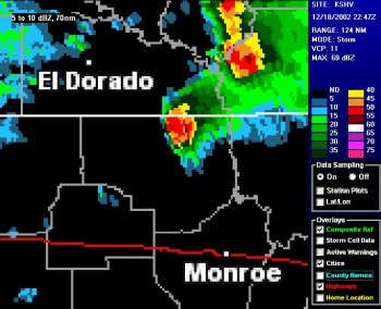
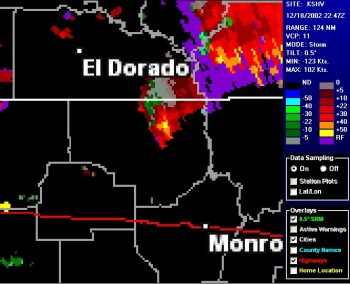
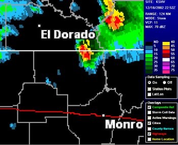
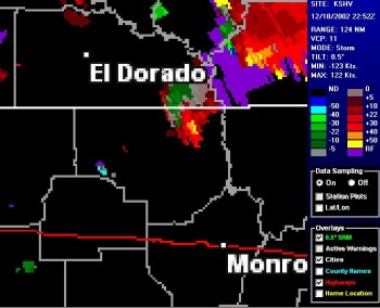
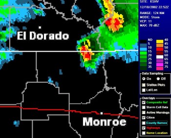
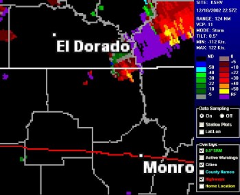
The storm dissipated quickly as it crossed the Arkansas border. Below are images of the storm as it progressed northeast across Union Parish. The left images are composite reflectivity and the right images are storm relative velocities. Note the strong rotation indicated by the red/green coupling in the velocity images. The images are at 4:36PM, 4:42PM, 4:47PM, 4:52PM, and 4:57PM. The photo above was taken at approximately 4:50PM.
Click HERE for damage photos and maps.
 |
 |
 |
 |
 |
 |
 |
 |
 |
 |