
Tropical Links
Tropical Prediction Center/National Hurricane Center
Detailed Atlantic Storm Pages
| ATL1 | ATL2 | ATL3 | ATL4 | ATL5 |
Atlantic Tropical Weather Outlook


 |
Latest Atlantic Basin Storm Advisories (Click on storm names below for additional information)
|
|
National Hurricane Advisory TCPAT1
National Hurricane Advisory TCPAT2
National Hurricane Advisory TCPAT3
National Hurricane Advisory TCPAT4
National Hurricane Advisory TCPAT5
Eastern Pacific Tropical Weather Outlook

Satellite Imagery

2019 Tropical Names
| ATLANTIC BASIN | EAST PACIFIC BASIN |
| Andrea Barry Chantal Dorian Erin Fernand Gabrielle Humberto Imelda Jerry Karen Lorenzo Melissa Nestor Olga Pablo Rebekah Sebastien Tanya Van Wendy |
Alvin Barbara Cosme Dalila Erick Flossie Gil Henriette Ivo Juliette Kiko Lorena Mario Narda Octave Priscilla Raymond Sonia Tico Velma Wallis Xina York Zelda |
NWS Coastal Radars
Sea Surface Temperatures


Saffir-Simpson Hurricane Scale
| Category 1 | 74-95 mph | 64-82 knots |
| Category 2 | 96-110 mph | 83-95 knots |
| Category 3 | 111-130 mph | 96-113 knots |
| Category 4 | 131-155 mph | 114-135 knots |
| Category 5 | >155 mph | >135 knots |
Retired Hurricane Names by Year
| 1954: Hazel | 1955: Connie, Diane, Ione, Janet | 1957: Audrey | 1959: Gracie |
| 1960: Donna | 1961: Carla, Hattie | 1963: Flora | 1964: Cleo, Dora, Hilda |
| 1965: Betsy, Carol | 1966: Inez | 1967: Beulah | 1968: Edna |
| 1969: Camille | 1970: Celia | 1972: Agnes | 1974: Carmen, Fifi |
| 1975: Eloise | 1977: Anita | 1979: David, Frederick | 1980: Allen |
| 1983: Alicia | 1985: Elena, Gloria | 1988: Gilbert, Joan | 1989: Hugo |
| 1990: Diana, Klaus | 1991: Bob | 1992: Andrew | 1995: Luis, Marilyn, Opal, Roxanne |
| 1996: Cesar, Fran, Hortense | 1998: Georges, Mitch | 1999: Floyd, Lenny | 2000: Keith |
| 2001: Allison, Iris, Michelle | 2002: Isidore, Lili | 2003: Fabian, Isabel, Juan | 2004: Charley, Frances, Ivan, Jeanne |
| 2005: Dennis, Katrina, Rita, Stan, Wilma | 2007: Dean, Felix, Noel | 2008: Gustav, Ike, Paloma | 2010: Igor, Tomas |
| 2011: Irene | 2012: Sandy | 2013: Ingrid | 2015: Erika, Joaquin |
| 2016: Matthew, Otto | 2017: Harvey, Irma, Maria, Nate |
| Most Intense Atlantic Storms by Pressure | ||
| Storm | Lowest Pressure (mb) | Lowest Pressure (in) |
| (1) 2005 Hurricane Wilma | 882 mb | 26.04 in |
| (2) 1988 Hurricane Gilbert | 888 mb | 26.22 in |
| (3) 1935 Florida Keys | 892 mb | 26.34 in |
| (4) 2005 Hurricane Rita | 897 mb | 26.48 in |
| (5) 1980 Hurricane Allen | 899 mb | 26.54 in |
| (6) 2005 Hurricane Katrina | 902 mb | 26.63 in |
| (7) 1998 Hurricane Mitch | 905 mb | 26.72 in |
| (8) 2007 Hurricane Dean | 906 mb | 26.75 in |
| (9) 1969 Hurricane Camille | 909 mb | 26.84 in |
| (10) 2004 Hurricane Ivan | 910 mb | 26.87 in |
| (11) 2017 Hurricane Irma | 914 mb | 26.99 in |
| (12) 2003 Hurricane Isabel | 915 mb | 27.01 in |
| (13) 1989 Hurricane Hugo | 918 mb | 27.10 in |
| (14) 2018 Hurricane Michael | 919 mb | 27.41 in |
| (14) 1992 Hurricane Andrew | 922 mb | 27.22 in |
| Most Intense Atlantic Storms by Wind | ||
| Storm | Sustained Winds | Lowest Pressure (in) |
| (1) 1980 Allen | 190 mph | 26.55 in |
| (2) Labor Day 1935 | 185 mph | 26.34 in |
| (3) 1988 Gilbert | 185 mph | 26.22 in |
| (4) 2005 Wilma | 185 mph | 26.05 in |
| (5) 2017 Irma | 185 mph | 27.34 in |
| (6) 2005 Rita | 180 mph | 26.43 in |
| (7) 1998 Mitch | 180 mph | 26.72 in |
| (8) 1932 "Cuba" | 175 mph | 27.02 in |
| (9) 1955 Janet | 175 mph | 26.99 in |
| (10) 1961 Carla | 175 mph | 27.49 in |
| (11) 1969 Camille | 175 mph | 26.58 in |
| (12) 1977 Anita | 175 mph | 27.34 in |
| (13) 1979 David | 175 mph | 27.29 in |
A Visit to the Tropical Prediction Center/National Hurricane Center. Click HERE for photos and details!
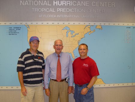
Mike Ridgeway (left) and Don Wheeler (right)
with former National Hurricane Center Director Max Mayfield (center)
(We're Not Worthy!!!!)
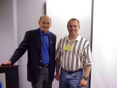
Jerry Jarrell, former director of the National Hurricane Center, and meteorologist Don Wheeler
egion1