
U.S. Time Zones and UTC Time
|
Tropical Links
Tropical Prediction Center/National Hurricane Center
Satellite Archives by Season
Atlantic Tropical Weather
Outlook
Full Text-Only Outlook


 |
Latest Atlantic Basin Storm Advisories (Click on storm names below for additional information)
|
|
National Hurricane Advisory TCPAT1
Full Text-Only Advisory
Tropical Cyclone Discussion TCDAT1
National Hurricane Advisory TCPAT2
Full Text-Only Advisory
Tropical Cyclone Discussion TCDAT2
National Hurricane Advisory TCPAT3
Full Text-Only Advisory
Tropical Cyclone Discussion TCDAT3
National Hurricane Advisory TCPAT4
Full Text-Only Advisory
Tropical Cyclone Discusstion TCDAT4
National Hurricane Advisory TCPAT5
Full Text-Only Advisory
Tropical Cyclone Discusstion TCDAT5
Eastern Pacific Tropical Weather Outlook
Eastern Pacific Tropical Weather Advisories/Discussions

Tropical Imagery
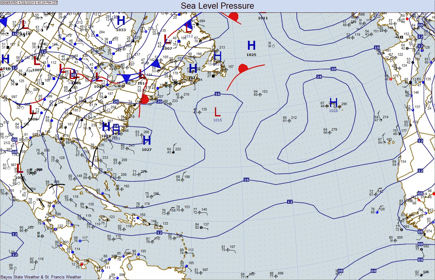
Surface Maps

2023 Tropical Names
| ATLANTIC BASIN | ATLANTIC ALTERNATE | EAST PACIFIC BASIN |
| Arlene Bret Cindy Don Emily Franklin Gert Harold Idalia Jose Katia Lee Margot Nigel Ophelia Philippe Rina Sean Tammy Vince Whitney |
Adria Braylen Caridad Deshawn Emery Foster Gemma Heath Isla Jacobus Kenzie Lucio Makayla Nolan Orlanda Pax Ronin Sophie Tayshaun Viviana Will |
Adrian Beatriz Calvin Dora Eugene Fernanda Greg Hilary Irwin Jova Kenneth Lidia Max Norma Otis Pilar Ramon Selma Todd Veronica Wiley Xina York Zelda |

Coastal Radars
Sea Surface Temperatures


Saffir-Simpson Hurricane Scale
| Category 1 | 74-95 mph | 64-82 knots |
| Category 2 | 96-110 mph | 83-95 knots |
| Category 3 | 111-129 mph | 96-112 knots |
| Category 4 | 130-156 mph | 113-136 knots |
| Category 5 | >156 mph | >136 knots |
Retired Hurricane Names by Year
| 1954: Hazel | 1955: Connie, Diane, Ione, Janet | 1957: Audrey | 1959: Gracie |
| 1960: Donna | 1961: Carla, Hattie | 1963: Flora | 1964: Cleo, Dora, Hilda |
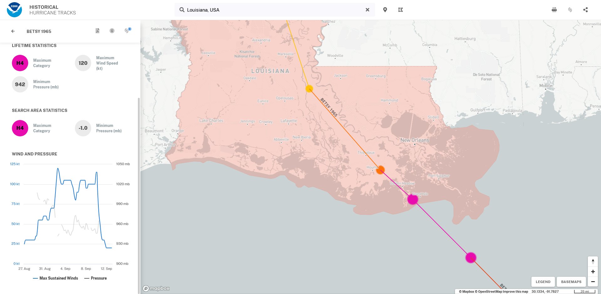
| 1965: Betsy, Carol | 1966: Inez | 1967: Beulah | 1968: Edna |
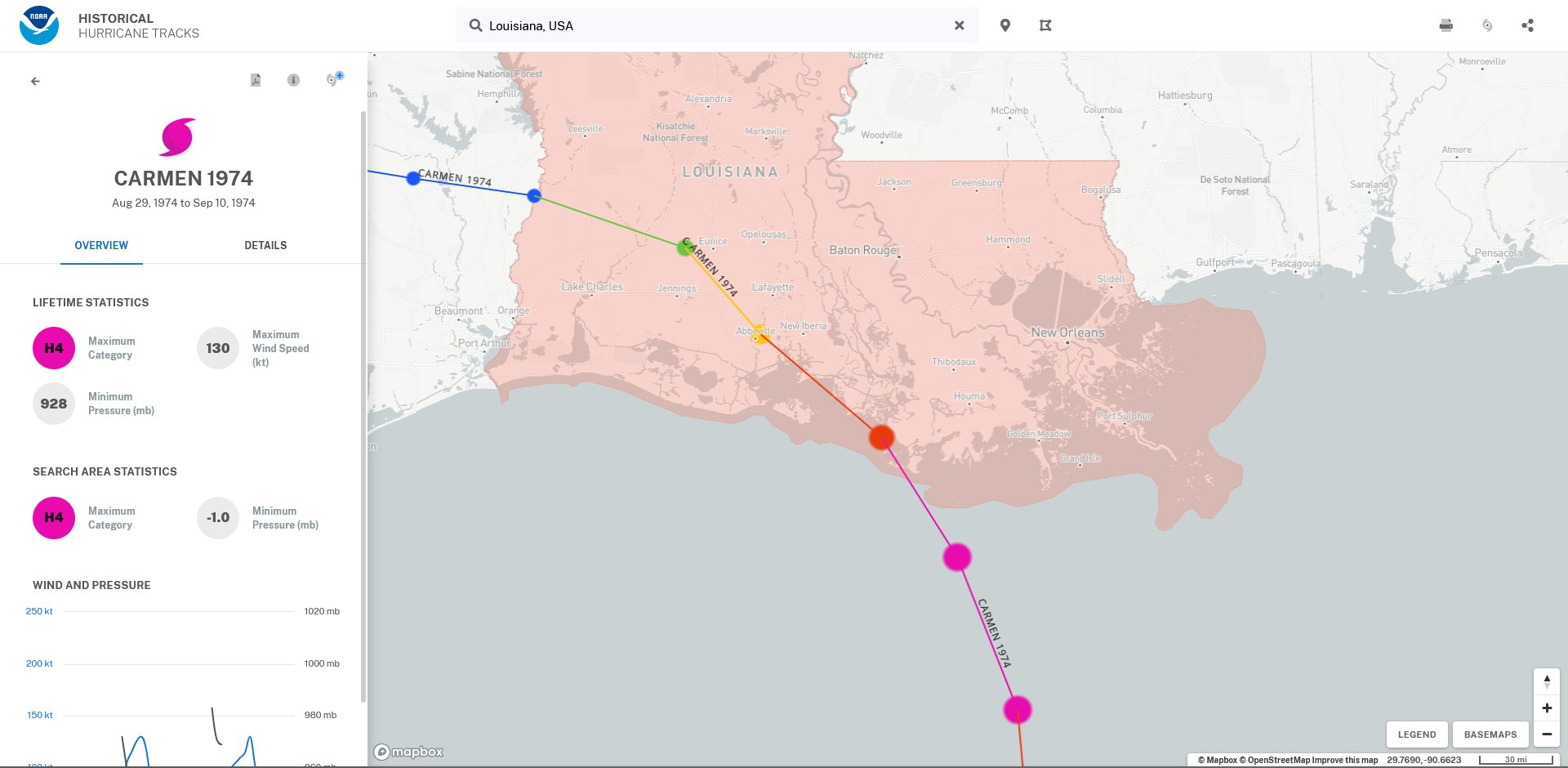
| 1969: Camille | 1970: Celia | 1972: Agnes | 1974: Carmen, Fifi |
| 1975: Eloise | 1977: Anita | 1979: David, Frederick | 1980: Allen |
| 1983: Alicia | 1985: Elena, Gloria | 1988: Gilbert, Joan | 1989: Hugo |
| 1990: Diana, Klaus | 1991: Bob | 1992: Andrew | 1995: Luis, Marilyn, Opal, Roxanne |
| 1996: Cesar, Fran, Hortense | 1998: Georges, Mitch | 1999: Floyd, Lenny | 2000: Keith |
| 2001: Allison, Iris, Michelle | 2002: Isidore, Lili | 2003: Fabian, Isabel, Juan | 2004: Charley, Frances, Ivan, Jeanne |
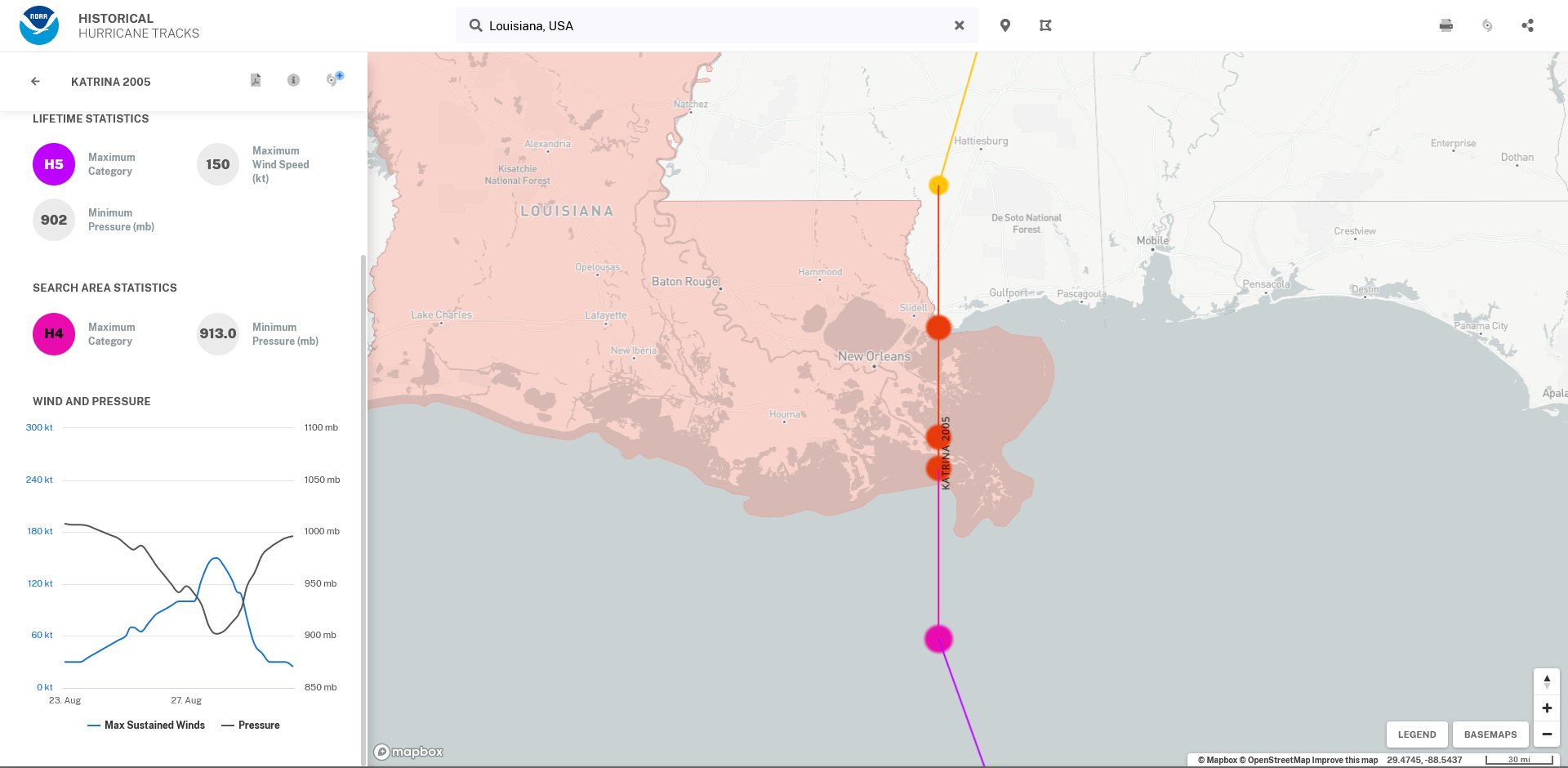
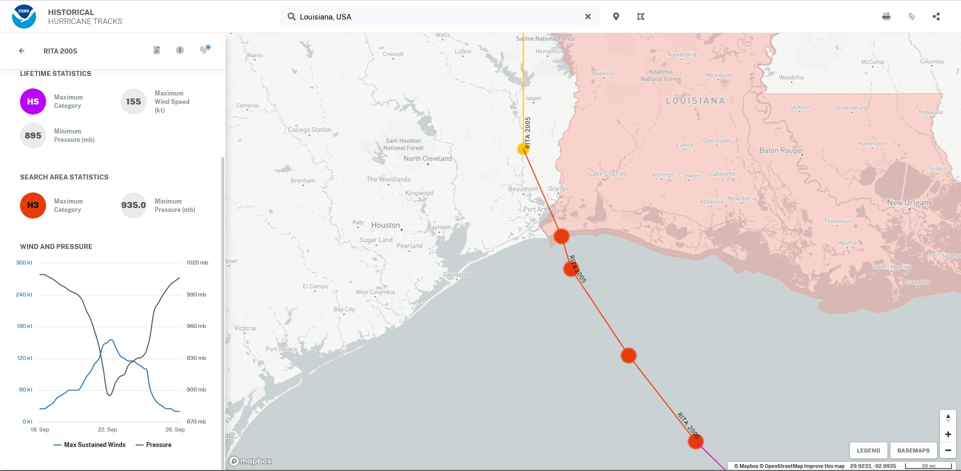
| 2005: Dennis, Katrina, Rita, Stan, Wilma | 2007: Dean, Felix, Noel | 2008: Gustav, Ike, Paloma | 2010: Igor, Tomas |
| 2011: Irene | 2012: Sandy | 2013: Ingrid | 2015: Erika, Joaquin |
| 2016: Matthew, Otto | 2017: Harvey, Irma, Maria, Nate | 2018: Florence, Michael | 2019: Dorian |
| 2020: Laura, Eta, Iota | 2021: Ida | 2022: Fiona, Ian |
| Most Intense Atlantic Storms by Pressure | ||
| Storm | Lowest Pressure (mb) | Lowest Pressure (in) |
| (1) 2005 Hurricane Wilma | 882 mb | 26.04 in |
| (2) 1988 Hurricane Gilbert | 888 mb | 26.22 in |
| (3) 1935 Florida Keys | 892 mb | 26.34 in |
| (4) 2005 Hurricane Rita | 897 mb | 26.48 in |
| (5) 1980 Hurricane Allen | 899 mb | 26.54 in |
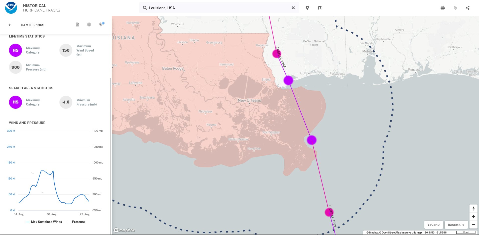
| (6) 1969 Hurricane Camille | 900 mb | 26.58 in |
| (7) 2005 Hurricane Katrina | 902 mb | 26.63 in |
| (8) 1998 Hurricane Mitch | 905 mb | 26.72 in |
| (9) 2007 Hurricane Dean | 906 mb | 26.75 in |
| (10 - tie) 2004 Hurricane Ivan | 910 mb | 26.87 in |
| (10 - tie) 2019 Hurricane Dorian | 910 mb | 26.87 in |
| (11) 2017 Hurricane Irma | 914 mb | 26.99 in |
| (12) 2003 Hurricane Isabel | 915 mb | 27.01 in |
| (13) 1989 Hurricane Hugo | 918 mb | 27.10 in |
| (14) 2018 Hurricane Michael | 919 mb | 27.14 in |
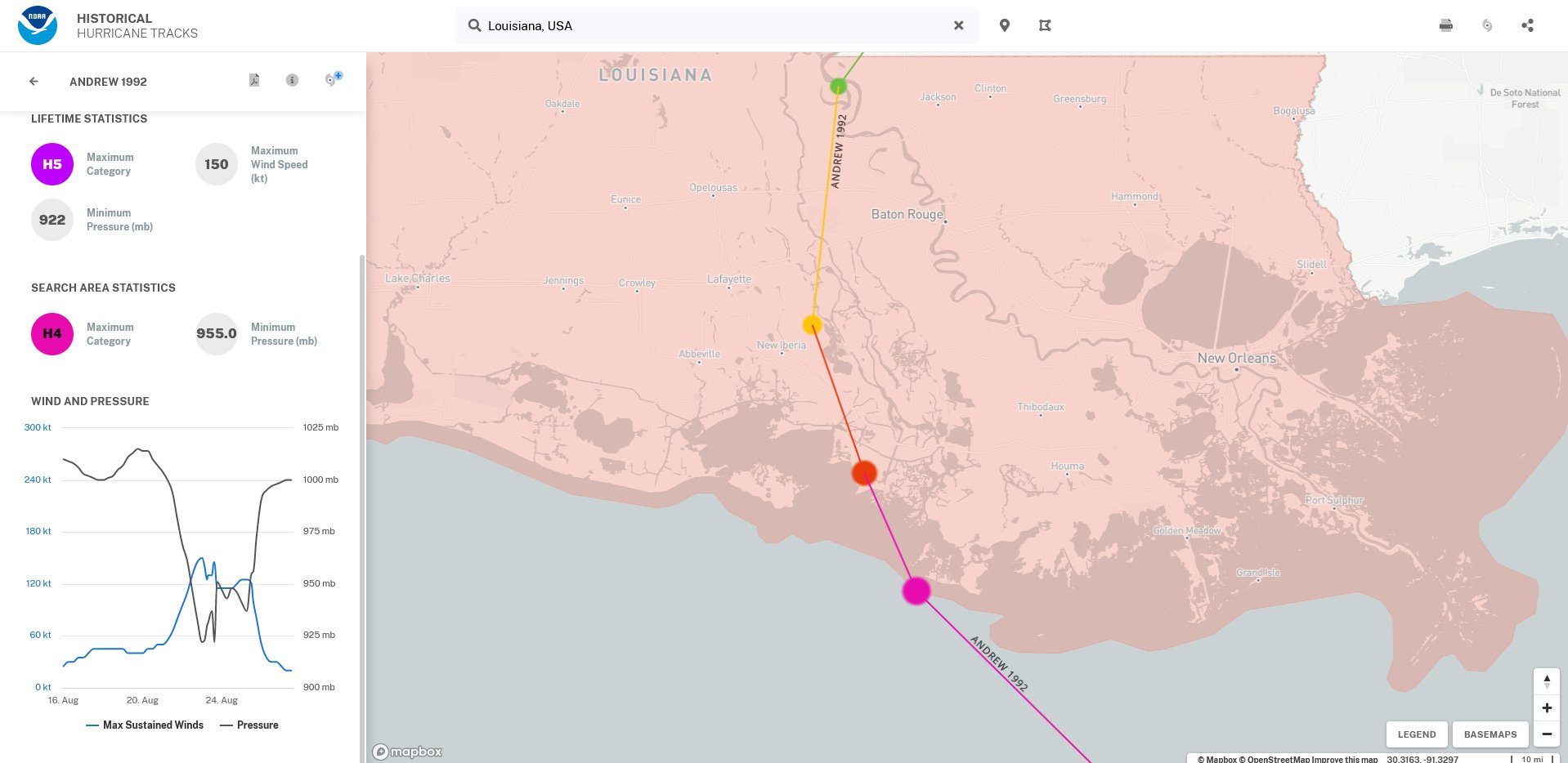
| (15) 1992 Hurricane Andrew | 922 mb | 27.22 in |
| Most Intense Atlantic Storms by Wind | ||
| Storm | Sustained Winds | Lowest Pressure (in) |
| (1) 1980 Allen | 190 mph | 26.55 in |
| (2) Labor Day 1935 | 185 mph | 26.34 in |
| (2) 1988 Gilbert | 185 mph | 26.22 in |
| (2) 2005 Wilma | 185 mph | 26.04 in |
| (2) 2017 Irma | 185 mph | 27.34 in |
| (2) 2019 Dorian | 185 mph | 26.87 in |
| (7) 2005 Rita | 180 mph | 26.43 in |
| (7) 1998 Mitch | 180 mph | 26.72 in |
| (9) 1932 "Cuba" | 175 mph | 27.02 in |
| (9) 1955 Janet | 175 mph | 26.99 in |
| (9) 1961 Carla | 175 mph | 27.49 in |
| (9) 1969 Camille | 175 mph | 26.58 in |
| (9) 1977 Anita | 175 mph | 27.34 in |
| (9) 1979 David | 175 mph | 27.29 in |
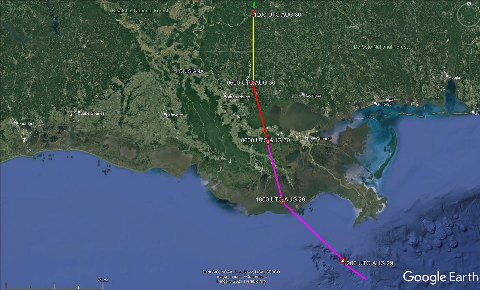
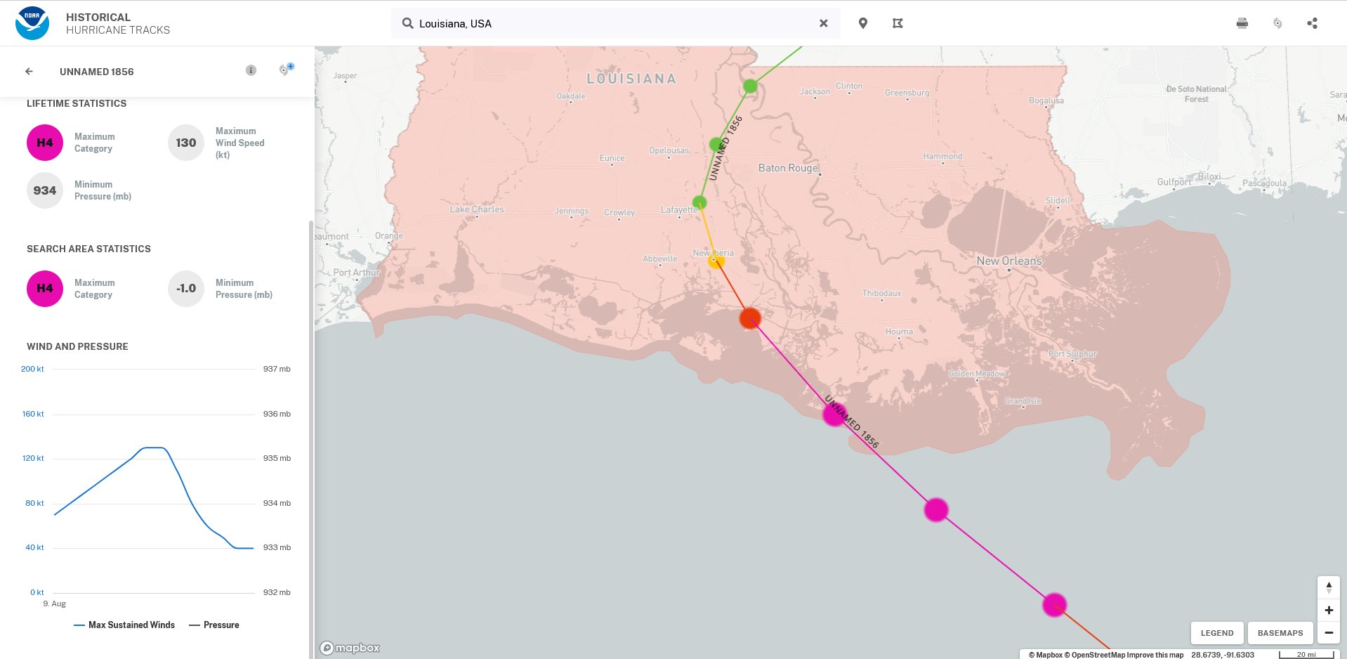
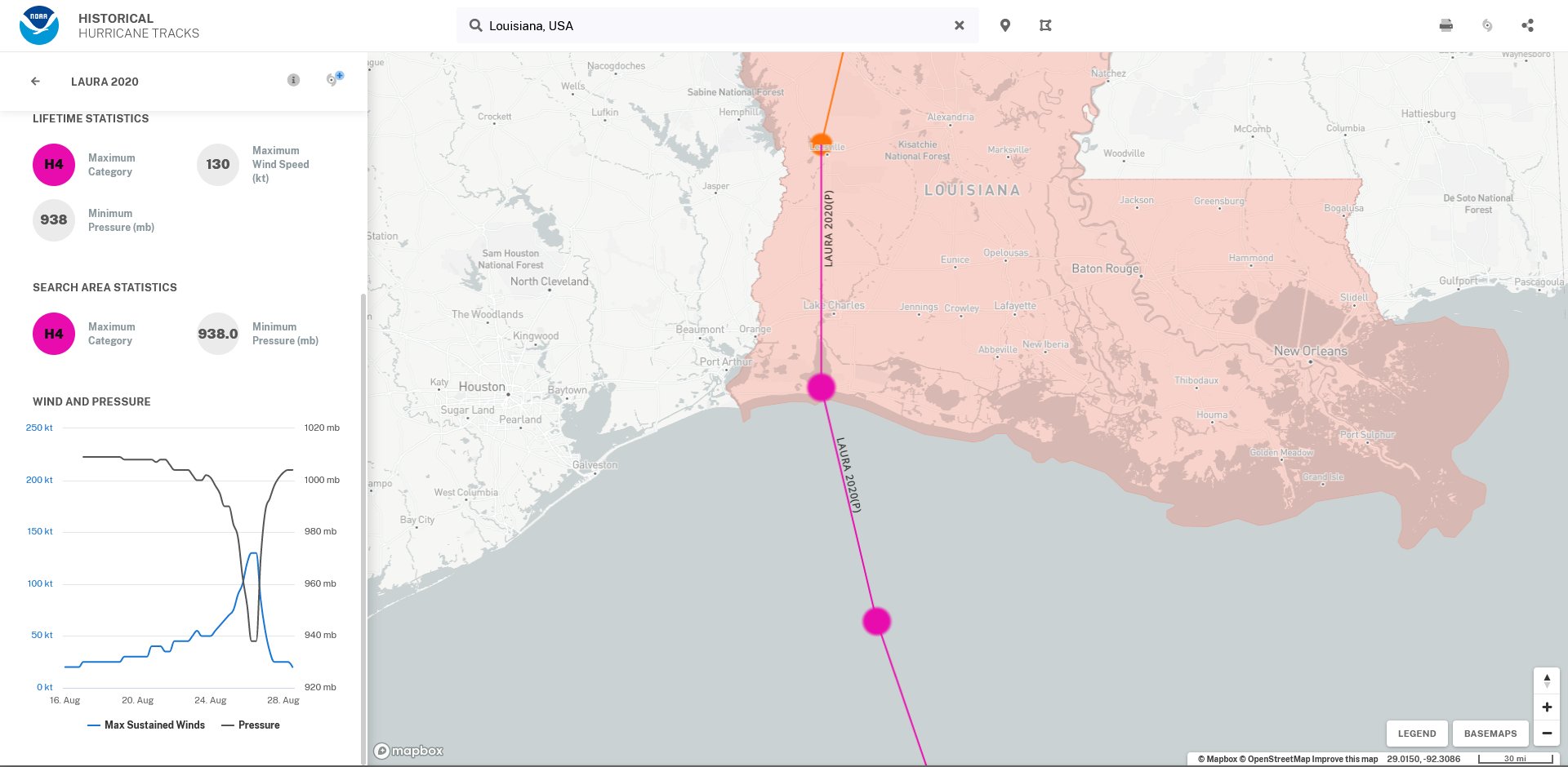
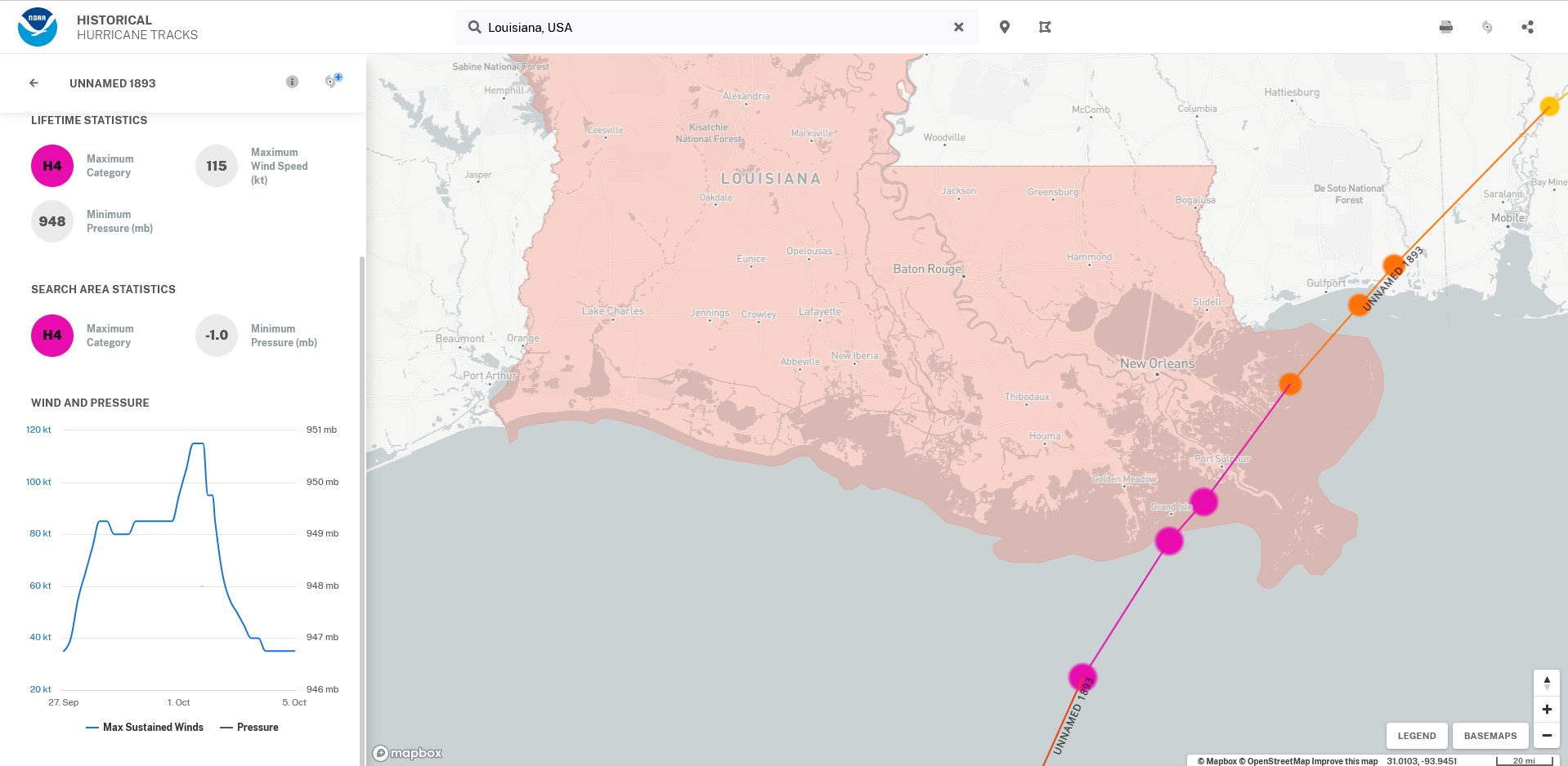
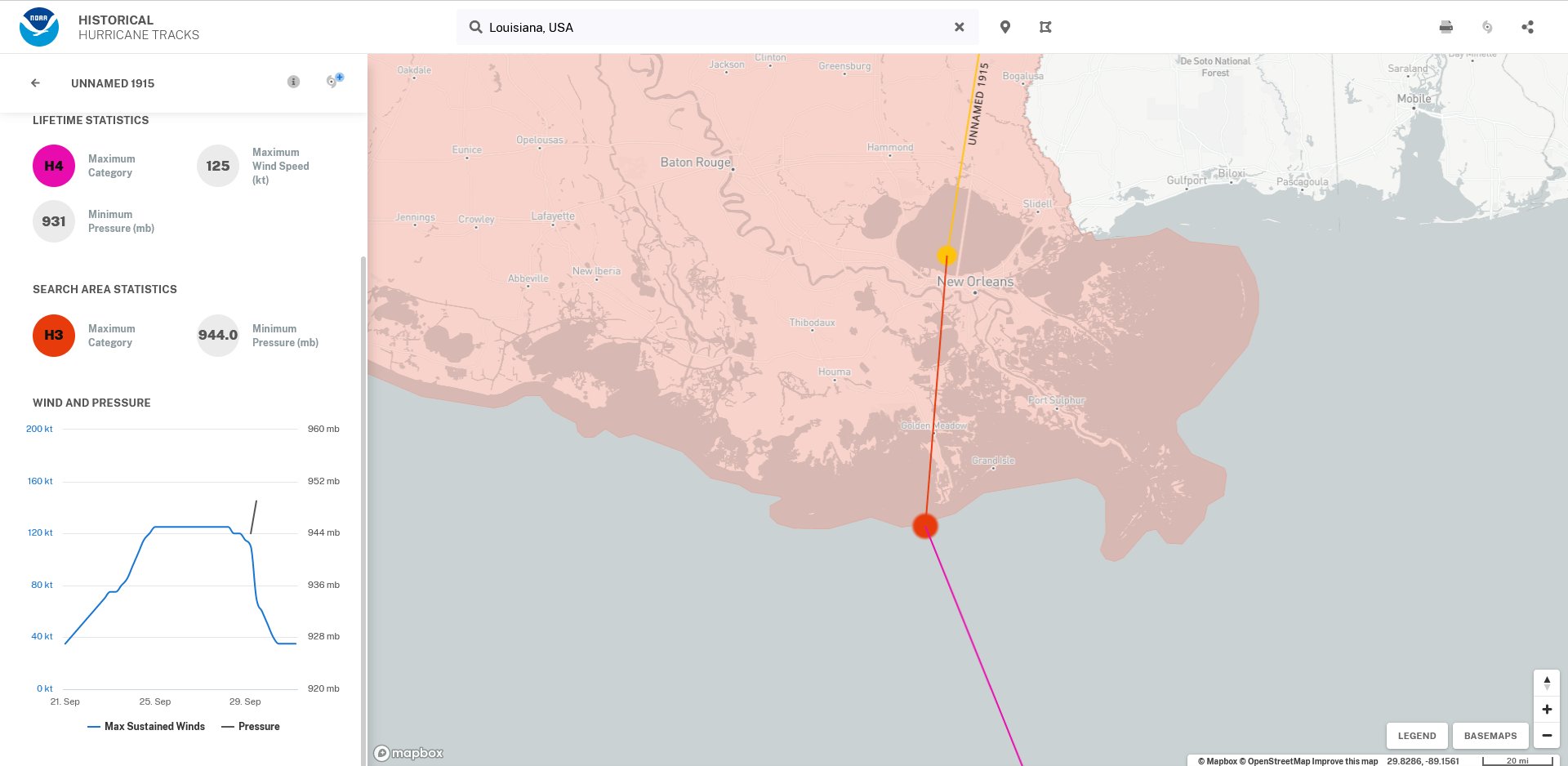
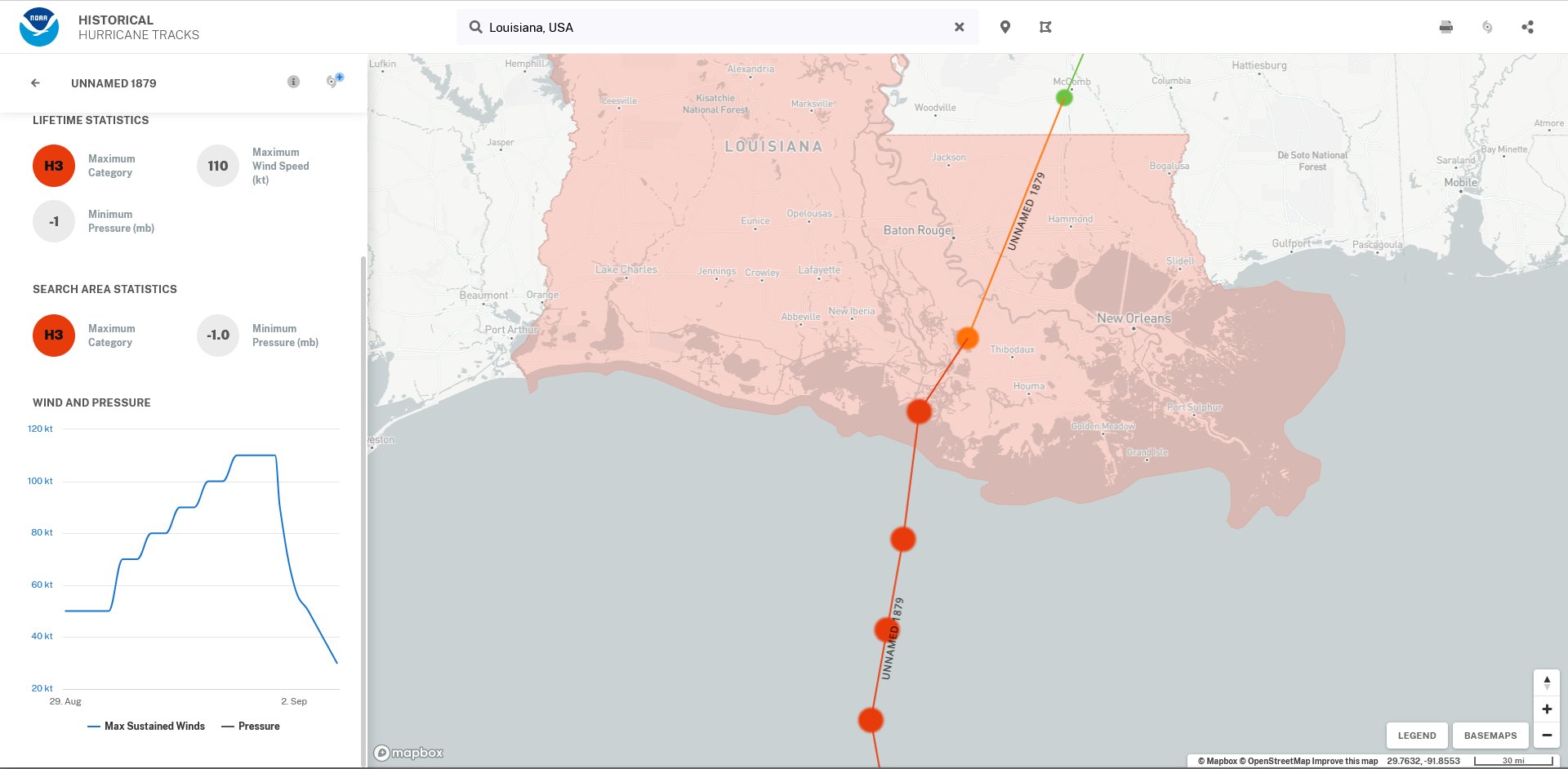
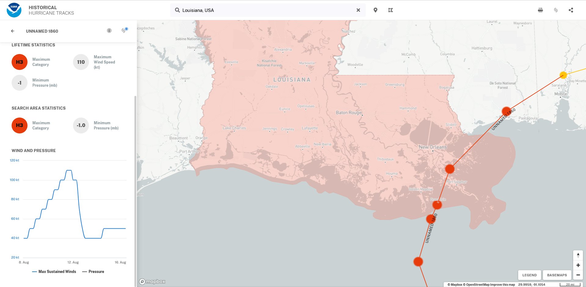
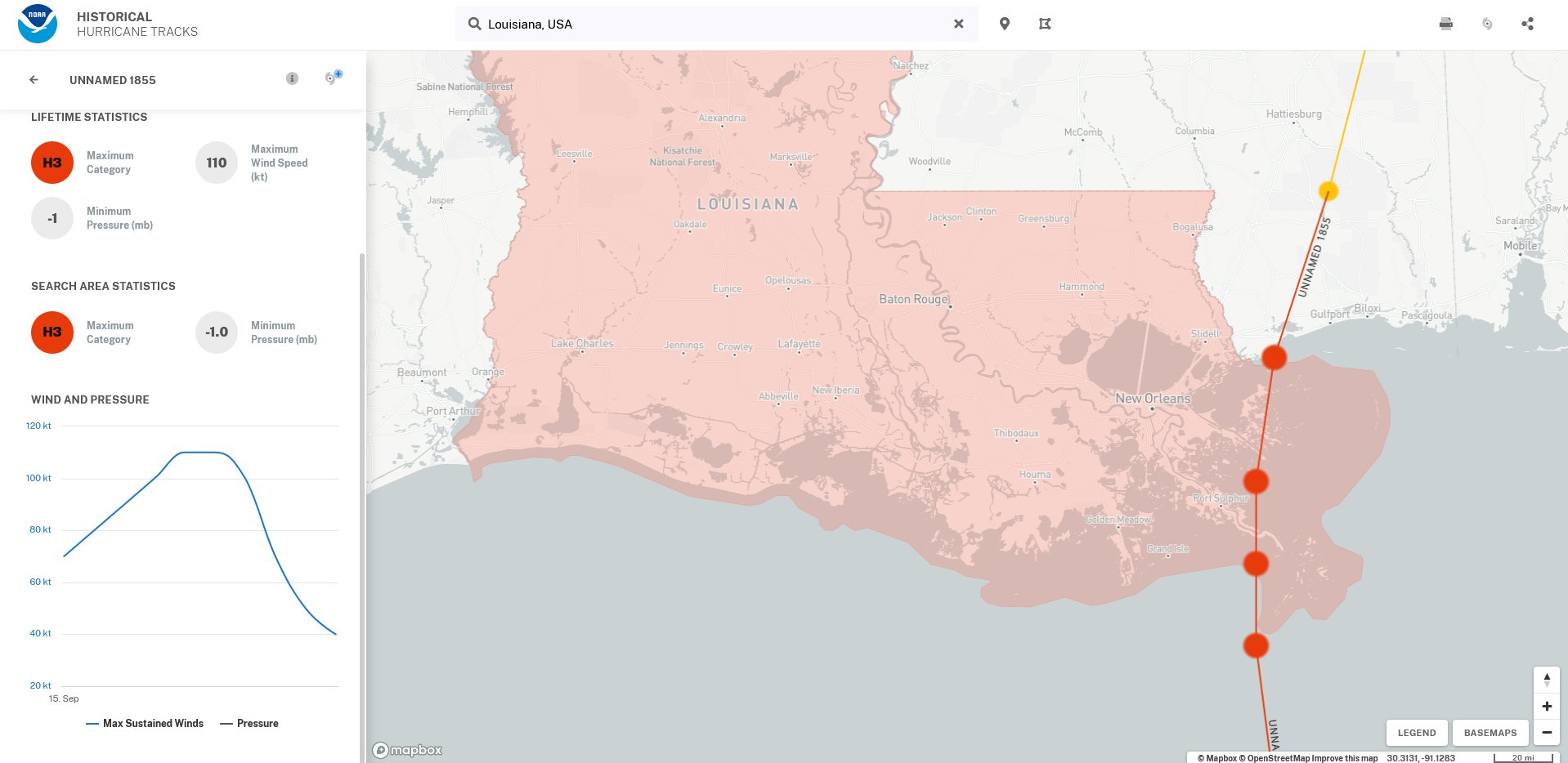
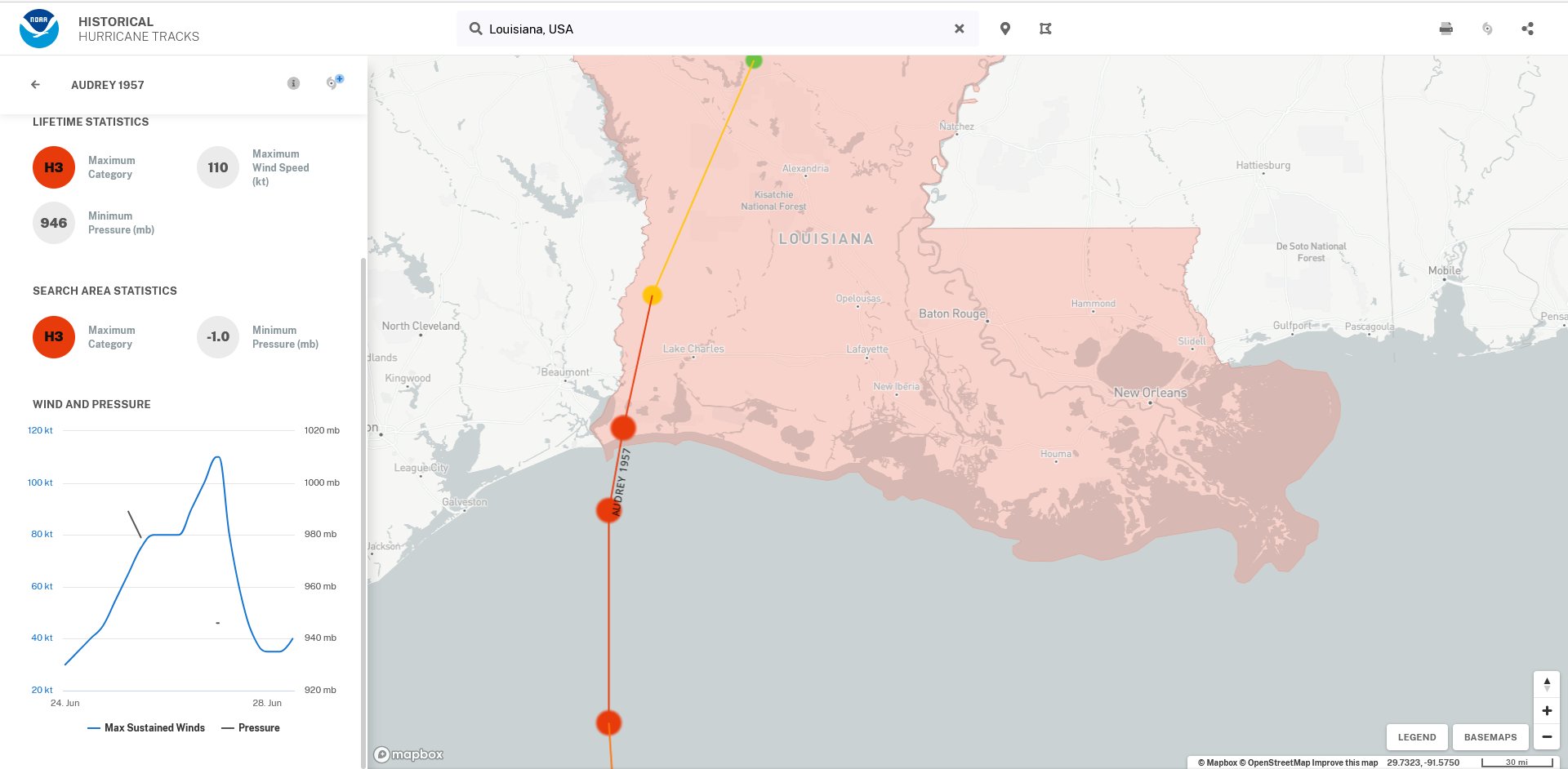
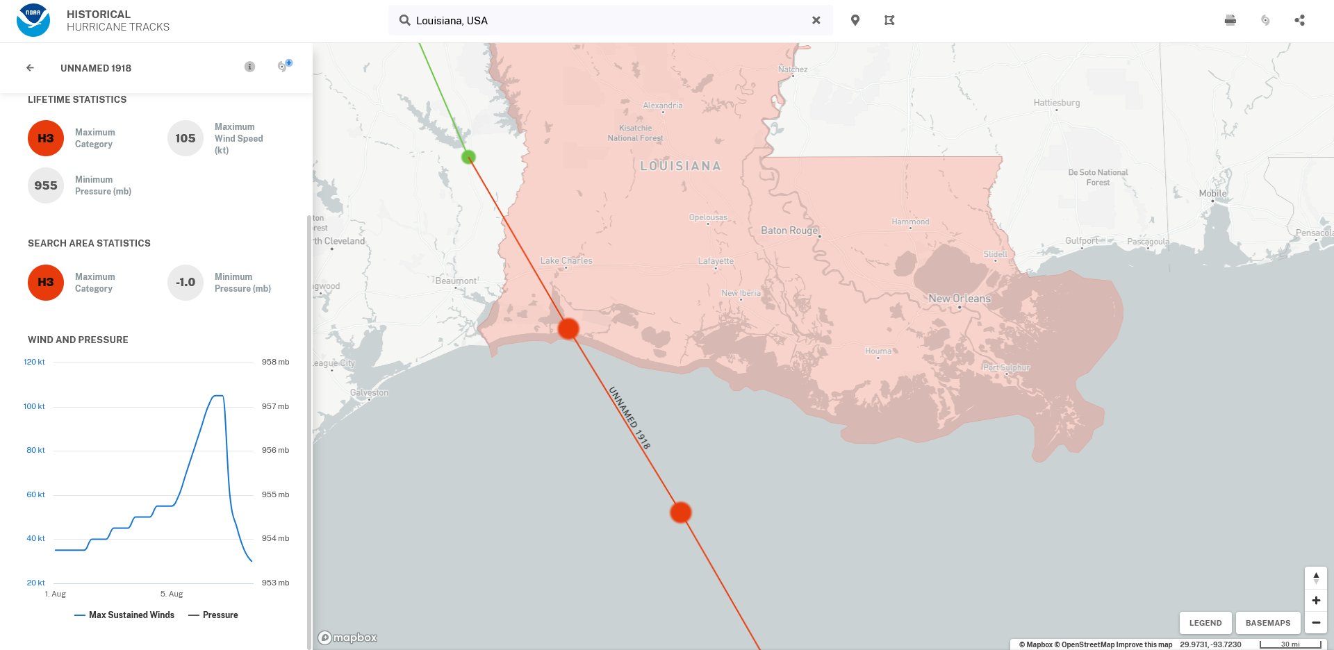
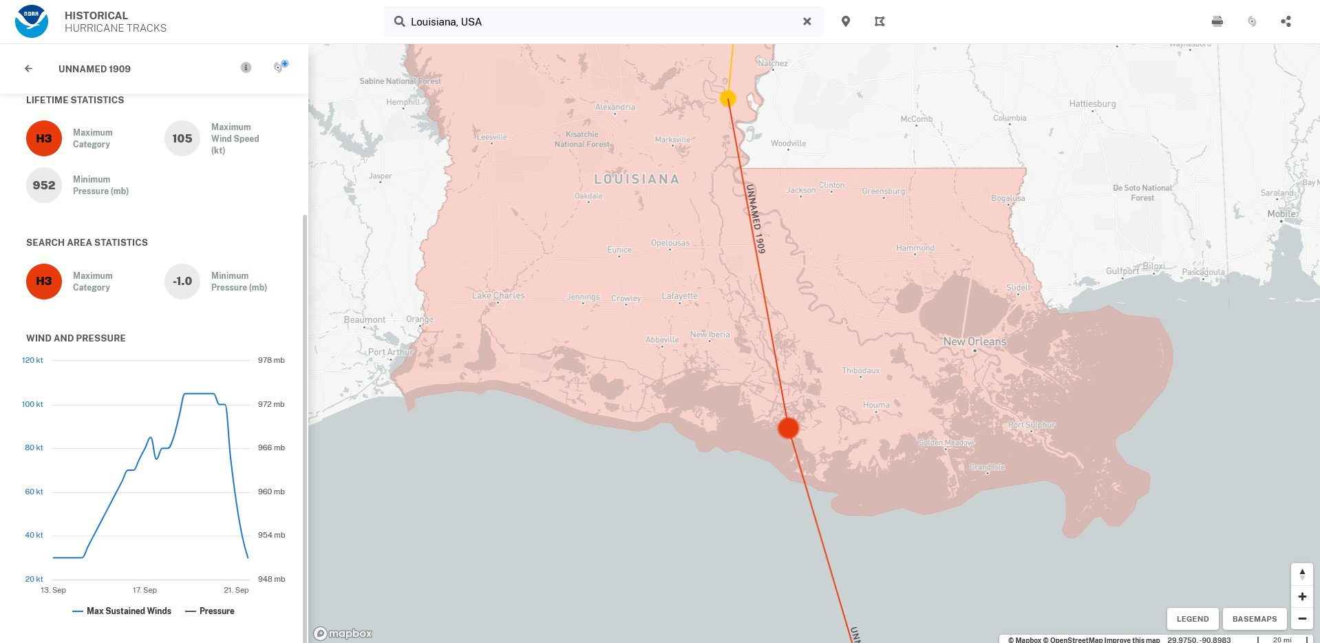
Strongest Landfalling Hurricanes to Strike Louisiana
|
*Hurricane Camille did not officially make landfall in Louisiana. The center moved north just to the east of extreme southeast Louisiana before making landfall in Pass Christian, Mississippi.
A Visit to the Tropical Prediction Center/National Hurricane Center. Click HERE for photos and details!
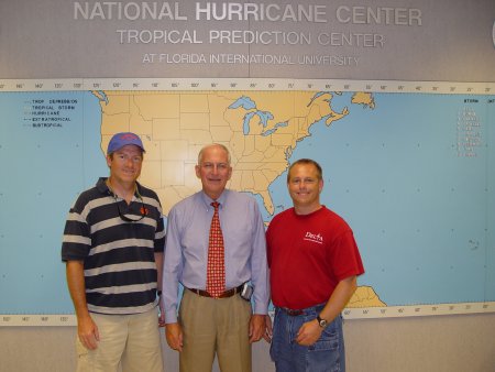
Mike Ridgeway (left) and Don Wheeler (right)
with former National Hurricane Center Director Max Mayfield (center)
(We're Not Worthy!!!!)

Jerry Jarrell, former director of the National Hurricane Center, and meteorologist Don Wheeler