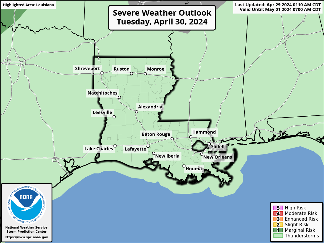
Bayou State Weather, LLC - Providing detailed weather information for Louisiana and surrounding areas
U.S. Time Zones and UTC Time
|
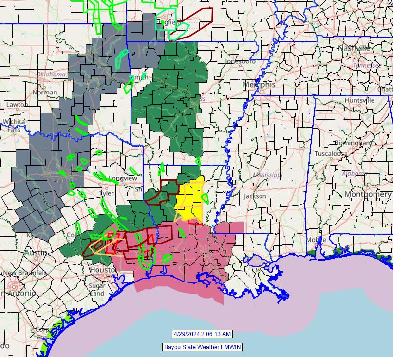
Latest Watch, Warning, and Advisories from Bayou State Weather EMWIN
(click on the map below for current watches, warnings, and advisories)
|
|
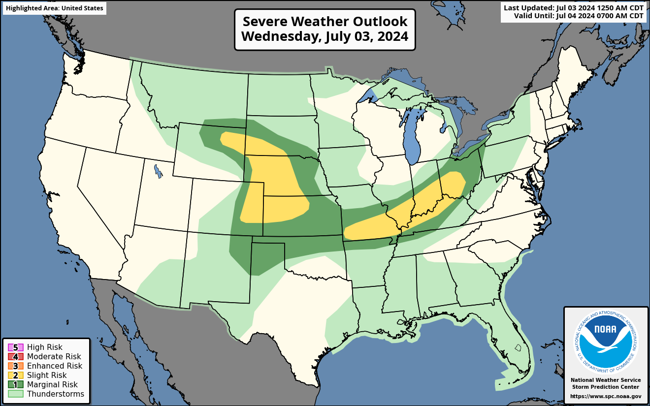
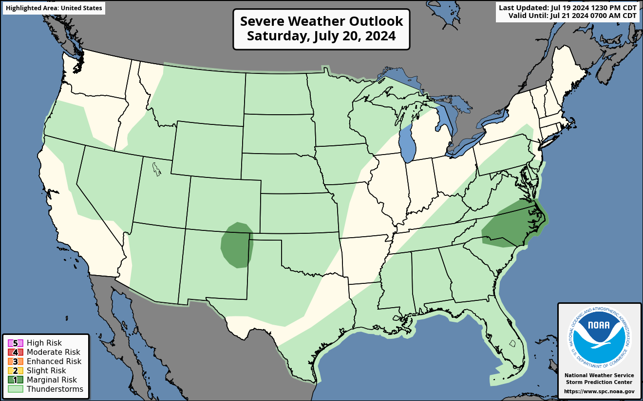
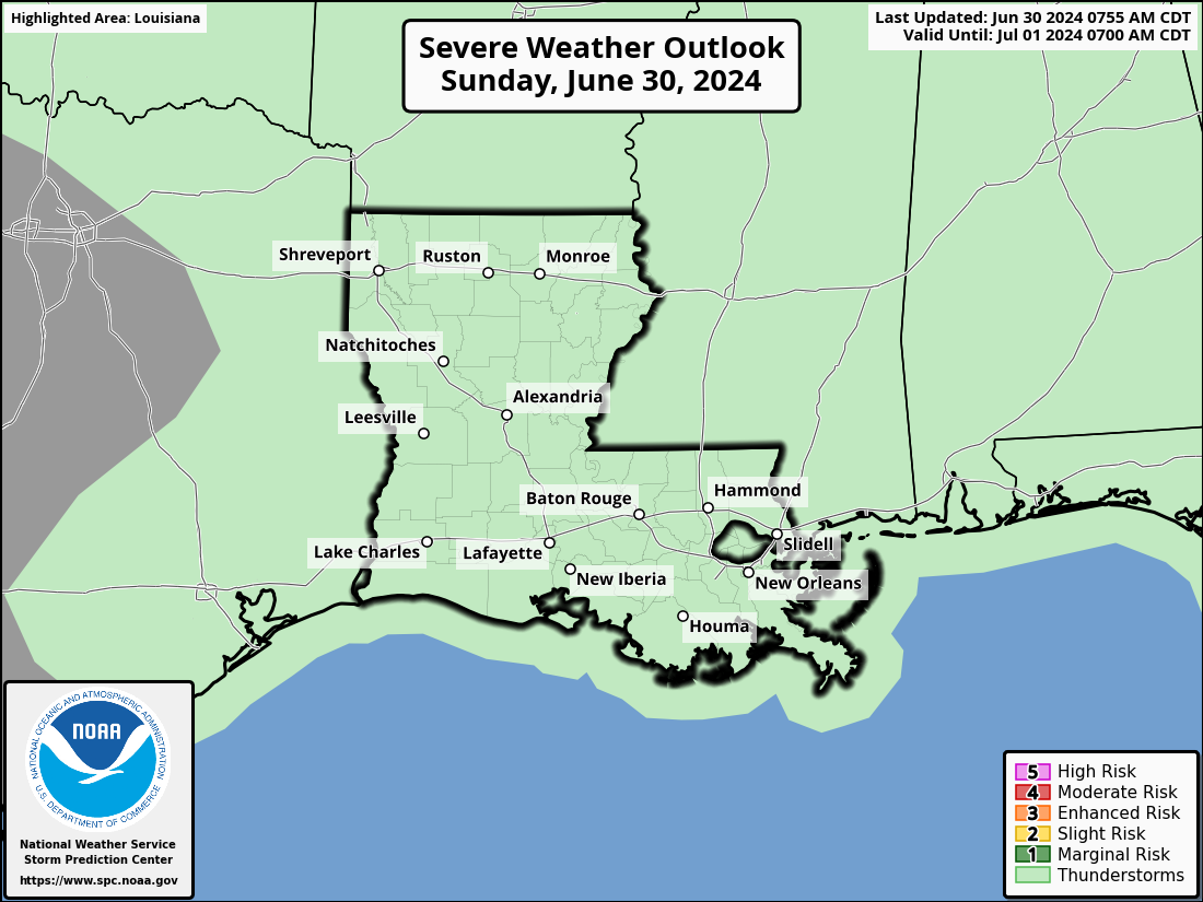
Day 1 Outlook Products |
Day 2 Outlook Products |
Day 3 Outlook Products |
 |
 |
 |
 |
 |
 |
 |
 |
 |
 |
 |
|
 |
 |
Extended Convective Outlooks - Day 4-8
Day 4 Outlook |
 |
 |
Day 5 Outlook |
 |
 |
Day 6 Outlook |
 |
 |
Day 7 Outlook |
 |
 |
Day 8 Outlook |
 |
 |
Severe Weather Categories

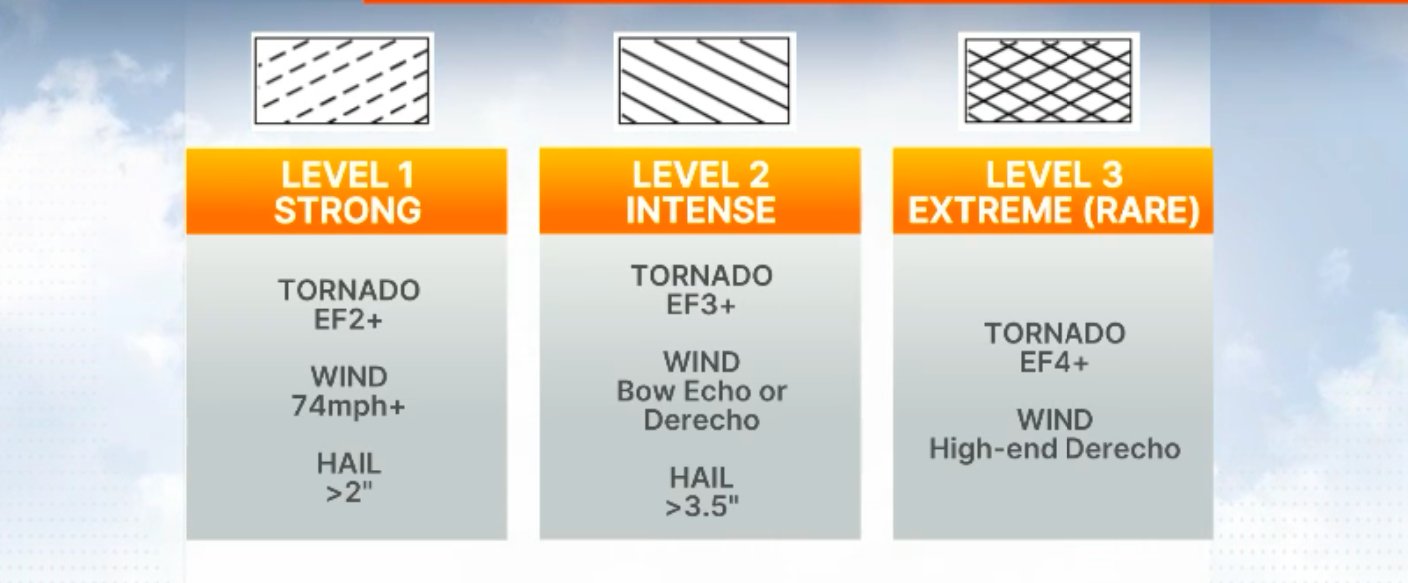

Tornado Threat |
|
Damaging Hail Threat |
Damaging Wind Threat |
Valid Watches Issued by the Storm Prediction Center |
Mesoscale Discussions |
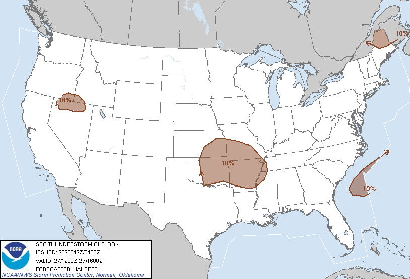
Thunderstorm Outlook - 0Z-4Z  |
Thunderstorm Outlook - 4Z-12Z 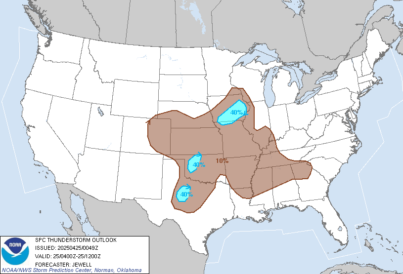 |
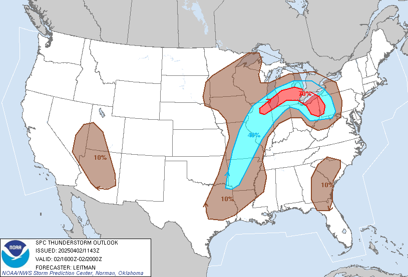
Thunderstorm Outlook - 16Z-20Z |
Thunderstorm Outlook - 20Z-0Z |


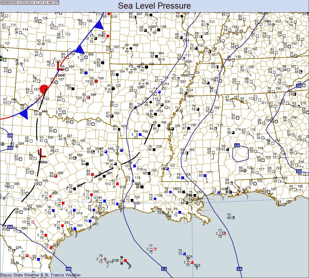
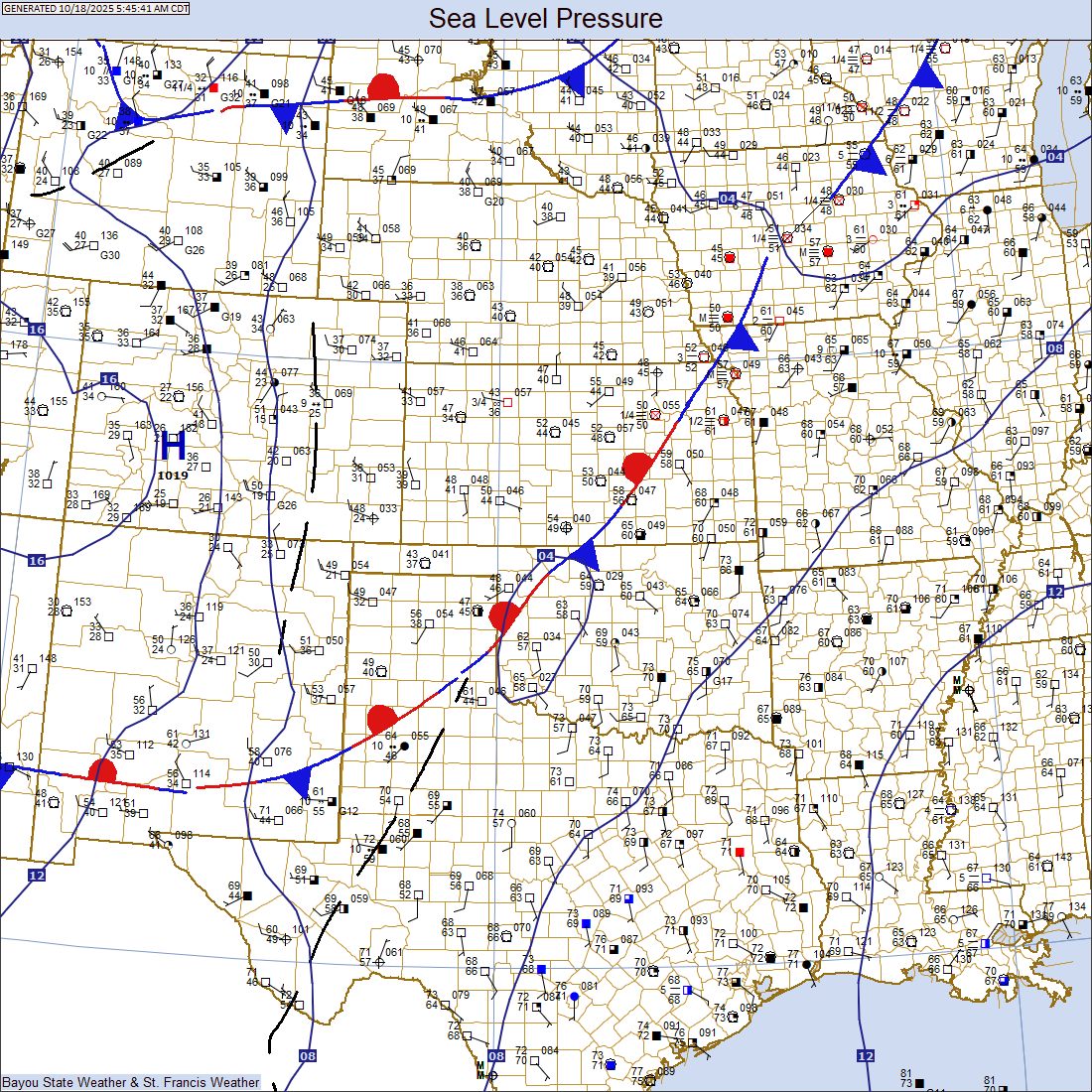
Mid-South Surface
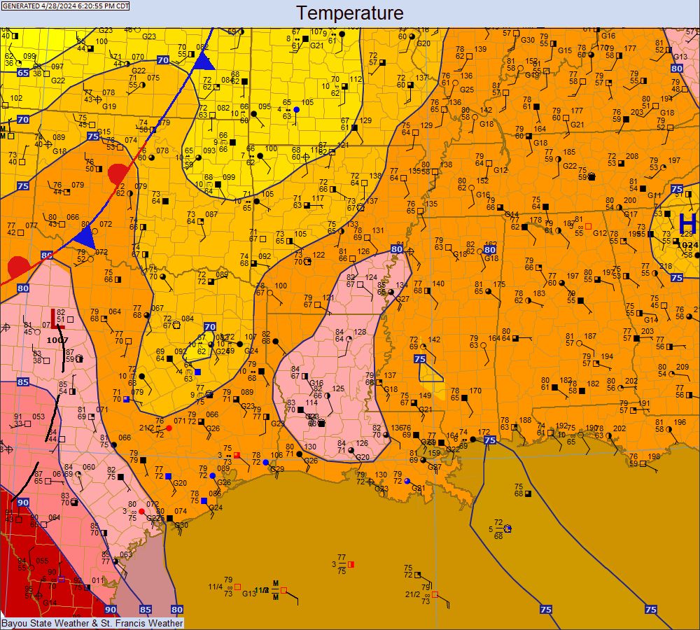
Mid-South Temperatures
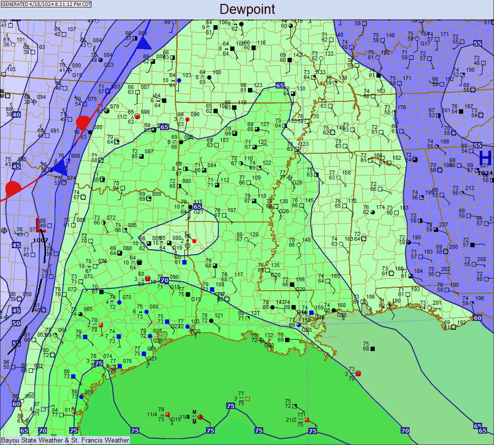
Mid-South Dewpoints
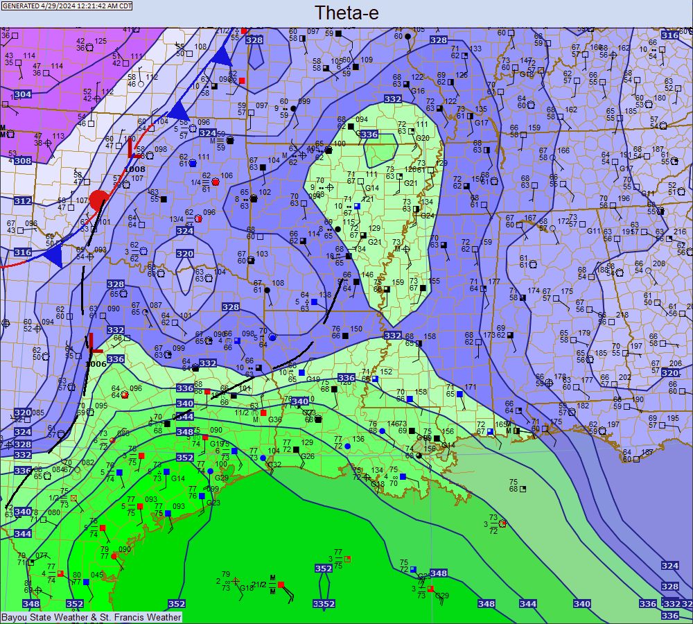
Mid-South Theta-E
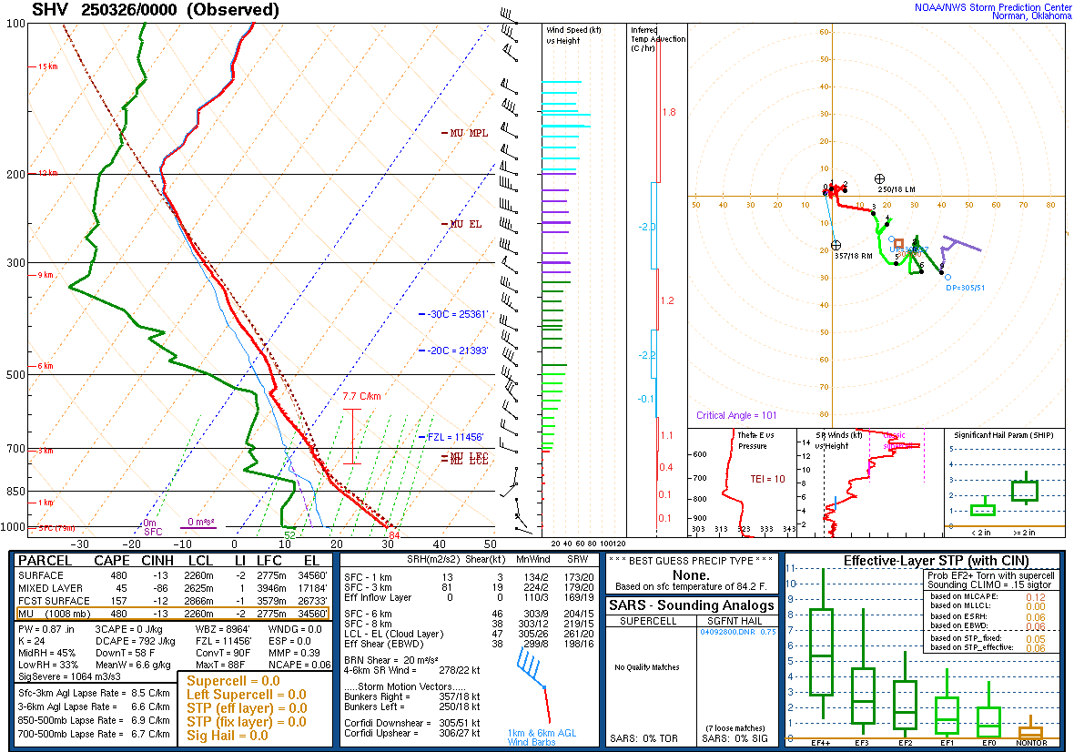
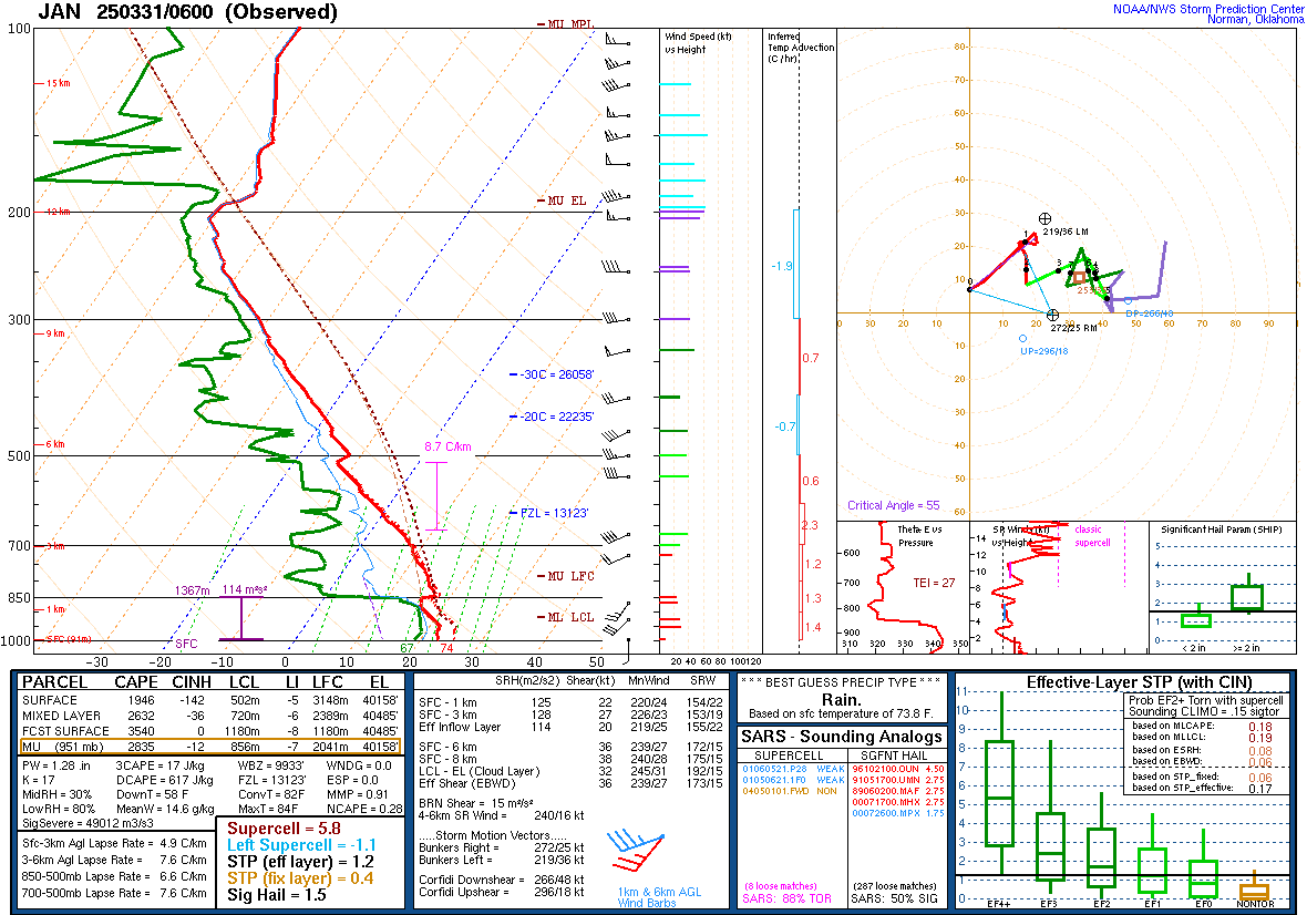
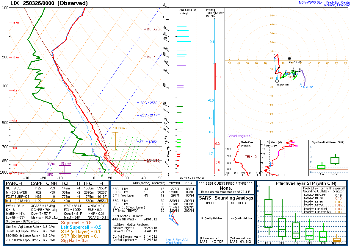
Skew-T
Radar
|